What comes with it and how our Fishing Spots work
Below, you can read what comes with each and every map area we offer. All fishing spot names and labels are “Matched” so switching between devices is not confusing and our files are easy to use over a variety of devices. The fishing spot names and comments match on all files, including the printable lat/long file mentioned below. Check it out!

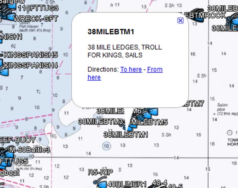
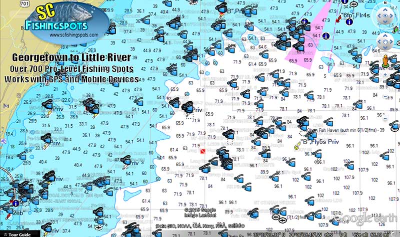
Google Earth Fishing Map File with NOAA Nautical Chart overlay! This file allows the use of multiple devices including iPhone, iPad, Android, Droid, and computers using the free Google Earth App. Many fishermen are now using a mobile device as fishing GPS to assist in studying and to help find fishing spots. This Google Earth Fishing Map file will also allow users to view information, and fishing spots notes or comments on each fishing spot provided by some of the best fishermen in each area. This file has matching names and labels to co-exist with your GPS files for easy studying or reading extended comments. (all included) See how this looks on our mobile device or computer with our included and integrated South Carolina NOAA Offshore Chart overlay!

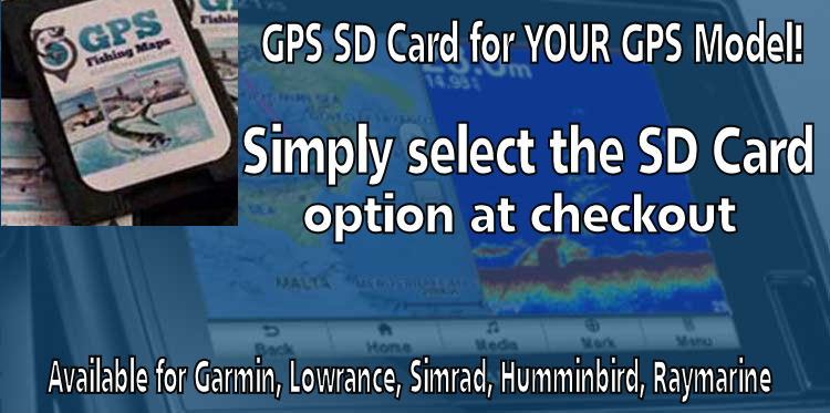
PRELOADED MICRO SD CARD FOR YOUR GPS
Preloaded Fishing Spots SD Cards! Get a micro SD card ready to load ALL your purchased fishing spots into your GPS! The proper SD card for your model will be loaded and mailed to your front door. How to get it – Simply add the SD card option at checkout, then select your GPS brand! All is found at checkout.

GPS Import/Upload File – Copy, Paste, load to your GPS and go Fishing! Does your GPS take an SD or Micro SD Card? Get ready for easy uploading! Our specially created copy and paste GPS files are designed to work with Garmin, Raymarine, Lowrance, Simrad and Humminbird GPSmodels that accept an SD Card. With this specially designed file, you can load all your new fishing spots to your GPS in one shot using the file and a blank SD Card! All Fishing spots names and labels on this GPS file will match your Mobile Device File(s) and your printable list of coordinates for easy matching up of Fishing Spots! (all included)
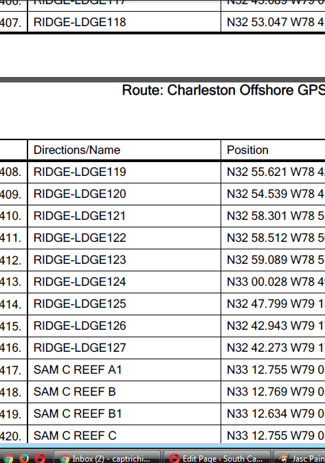
A GPS Coordinates List is included with any fishing locations. This is a PDF file with each and every fishing spot showing each individual Lat/Long on our map for entering GPS numbers into any GPS device or program in the world. All Labels and names on these fishing spots will match the fishing spots on your other files for ease of use to match your fishing spots throughout your area using any device you own. (all included)
Fishing and Rigging Tutorials – That’s right, we have fishing and rigging tutorials for Offshore Trolling, Bottom Fishing and more. These are included UPON REQUEST to match the fishing spots area you have purchased. (included with any purchase) Request rigging and fishing tutorial here!

This Fishing Map system is very easy to use, multifunctional over a variety of GPS units and Mobile devices using simple copy and paste files.
As of this season, we now celebrate 10-Years in the GPS Fishing Map business with a 98% positive feedback rating from our customers throughout the southern states! This is a number we’re proud of, and we intend to keep it. Thank ALL of you for your business and support and we look forward to serving new customers this season!
Tight Lines and Good Fishing to All!
Please feel free to contact us with ANY questions you may have. For a fast reply, please use the quick contact form found here